- Messages
- 325
- Reaction score
- 77
- Points
- 38
I was wondering if anyone has the following maps according to the syllabus to help us identify places, rivers, latitudes ect:
Latitudes : 30 N, 36 N
Longitudes: 64 E, 70 E and 76 E
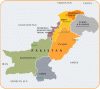
All provinces including Northern Area and FATA
Cities: Islamabad, Rawalpindi, Gujranwala, Lahore, Faisalabad, Multan, Sialkot, Peshawar, Chitral, Hydrabad, Karachi, Quetta and Gwadar
Landforms: Balochistan Plateau, Sulaiman Range, Safed Koh, Potwar Plateau, Salt Range, Hindu Kush, Karakoram, Himalaya Mountain Ranges
Rivers: Kabul, Hab, Dasht (and 5 main rivers, too)
Deserts:Thar, Thal, Kharan
It would be appreciated if all factors are on different maps..It may be easier for us to learn them.
Latitudes : 30 N, 36 N
Longitudes: 64 E, 70 E and 76 E
All provinces including Northern Area and FATA
Cities: Islamabad, Rawalpindi, Gujranwala, Lahore, Faisalabad, Multan, Sialkot, Peshawar, Chitral, Hydrabad, Karachi, Quetta and Gwadar
Landforms: Balochistan Plateau, Sulaiman Range, Safed Koh, Potwar Plateau, Salt Range, Hindu Kush, Karakoram, Himalaya Mountain Ranges
Rivers: Kabul, Hab, Dasht (and 5 main rivers, too)
Deserts:Thar, Thal, Kharan
It would be appreciated if all factors are on different maps..It may be easier for us to learn them.